Navigation platform for emergency services
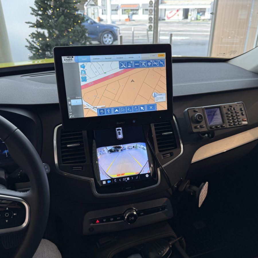
CityGIS navigator is a specialised GPS navigation platform that includes a full GIS environment.
This allows to save precious time to reach incident locations by using exact house number navigation and aerial photo layers.
The Tersec-CityGIS integrations also allow to receive incident locations directly from the 112 centers and offers bidirectional status reporting based on Tetra and/or cellular communications.
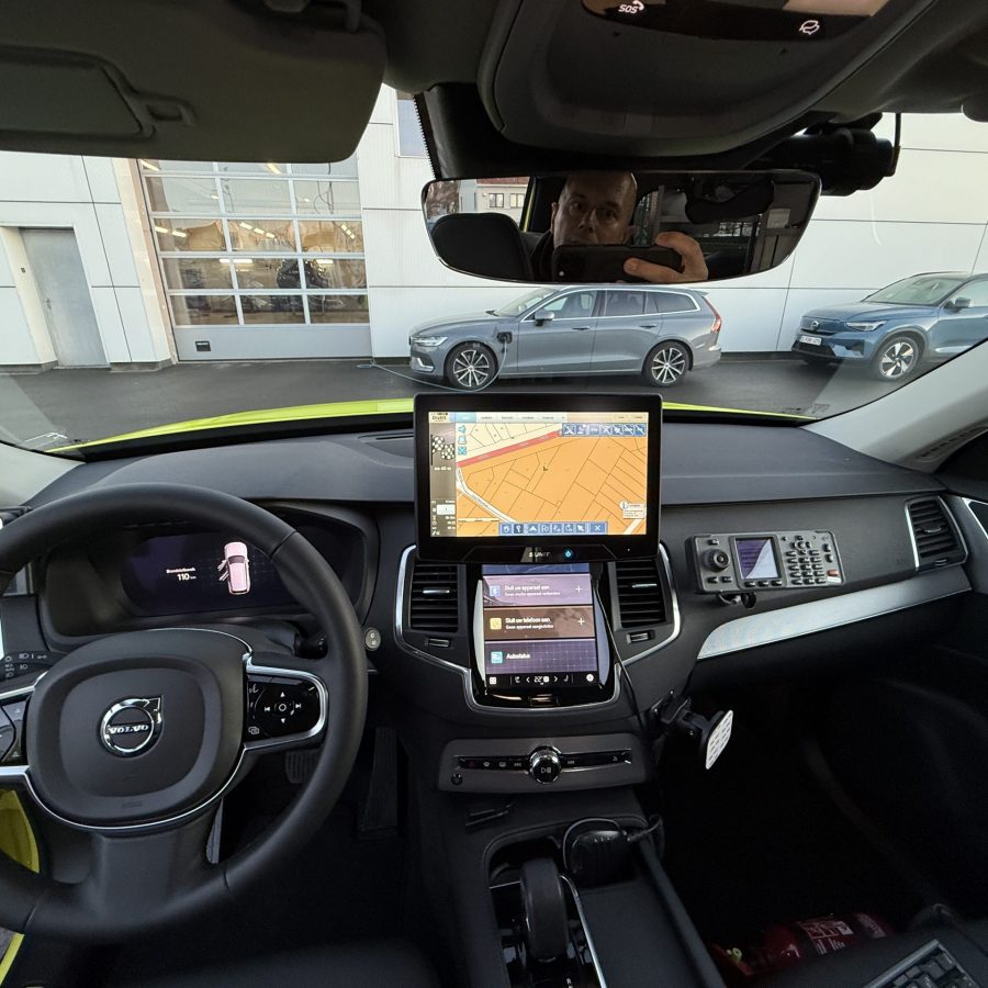
This can be installed as a fixed mobile PC setup inside of a vehicle. Police cars, fire brigade cars and emergency service cars and helicopters are equipped with this software.
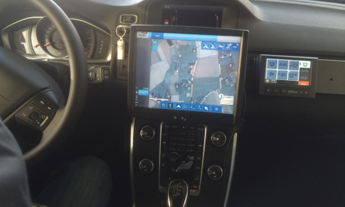
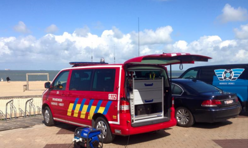
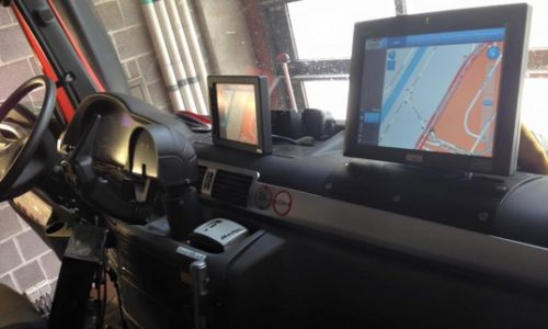
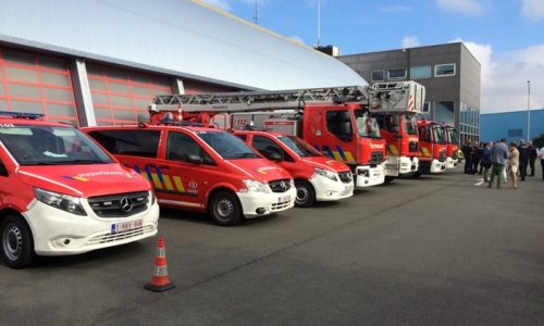


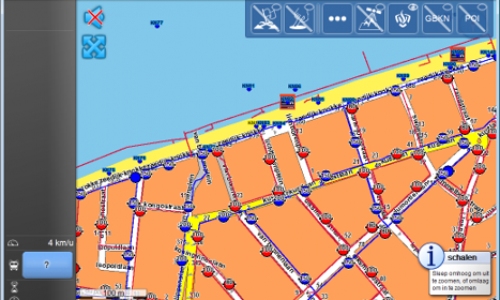
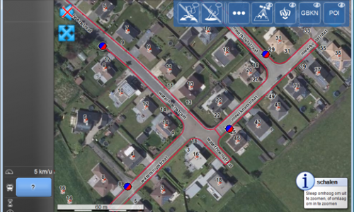
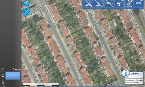
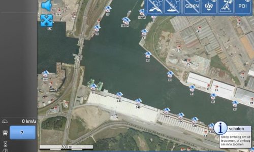


The navigation platform consists of a multi-layer GIS. There are different types of layers that you can show on the screen.
There are a lot of customisations possible to meet the requirements of the customer. You can show the water network and hydrants, see an aerial view or a map view, show the house numbers, see the quay numbers in a port…
Some other features of the navigation platform:
- Send and receive status messages via 4G/5G/Tetra
- Receive live incidents from 112 emergency service centers via Tetra/IP
- Control Tetra radio - select talk group and control volume
- Report of Tetra / Astrid missions
- Integration with on-board vehicle systems
- Control blue lights / siren - Go112 integration
Nieuwe MUG wagen Sint Andries ziekenhuis Tielt
13-01-25 |Tielt, België
Tersec voorziet CityGIS navigator platform met Go112 integratie in nieuwe MUG wagen Sint Andries ziekenhuis Tielt
– integratie met Astrid boordradio- automatische ontvangst incidentlocatie via de HC 112 noodcentrale
/ SDS 2 GPS
– integratie statussen Astrid
– navigatie op huisnummerniveau via integratie kadaster huisnummerinformatie + visualisatie percelen
– hoge resolutie luchtfotolaag
– navigatie routering mogelijk via buslanen e.d. die enkel toegankelijk zijn voor prioritaire voertuigen
– integratie interventieplannen + NIP + BNIP
– naadloze Go112 integratie – aansturing signalisatie via touchscreen
– selecteren Astrid favoriete gespreksgroepen via touchscreen
– uitlezen E-ID m.b.v. geïntegreerde E-ID reader gekoppeld aan de mobiele PC
– overzicht uitgevoerde ritten
Na 10 jaar succesvol gebruik van het CityGIS navigator platform in de vorige MUG wagen
werd beslist om ook in de nieuwe MUG wagen te kiezen voor dit platform.
Door gebruik te maken van dit navigatieplatform ,dat specifiek werd ontwikkeld voor hulpdiensten, kunnen kostbare minuten worden gespaard bij het aanrijden naar kritieke interventies.
Dank aan AZ Sint-Andriesziekenhuis voor het jarenlange vertrouwen & AB Technics voor de samenwerking
& de kwalitatieve inbouw. Dank ook aan Lions Club Tielt voor de ondersteuning van dit project.





New EMS/MUG vehicle for Sint Andries hospital Tielt
13-01-25 | Tielt, Belgium
Tersec provides CityGIS navigator platform with Go112 integration in new MUG car Sint Andries hospital Tielt
– integration with TETRA/ASTRID onboard radio – automatic reception of incident location via the HC 112 emergency center
/ SDS 2 GPS
– integration of Astrid statuses – send & receive status
– navigation at house number level via integration with land register house number information + visualization of parcels
– high resolution aerial photo layer
– navigation routing possible via bus lanes etc. that are only accessible for emergency vehicles
– integration of intervention plans + NIP + BNIP
– seamless Go112 integration – control of blue lights / siren via touch screen
– select TETRA/ASTRID favorite call groups via touchscreen
– read out patient identity with integrated E-ID reader linked to the mobile PC
– overview of completed missions
After 10 years of successful use of the CityGIS navigator platform in the previous EMS/MUG vehicle
it was decided to use this platform in the new EMS/MUG vehicle as well.
By using this navigation platform, which was specifically developed for emergency services, valuable minutes can be saved when driving to critical interventions.
Thanks to AZ Sint-Andriesziekenhuis for the many years of trust & AB Technics for the cooperation & the high-quality installation.
Thanks also to Lions Club Tielt for supporting this project.
